Article Title :
Application of Sentinel-1A SAR Data for Village Level Flood Inundation Mapping in Malda District, West Bengal, India
7 (2023)
1-13
SAR , Rural Flood , River Basin , Remote Sensing , Ganga , Flood Inundation


It’s no exaggeration to say that floods are among the most common and catastrophic natural disasters, with widespread impacts on ecosystems and human lives. The World Bank has concluded that India is one of the most flood-prone countries in the world. This research has been focused on identification of real-time flood hazard area in the Malda district (India) using SAR data, Sentinel-1A (C-band). ArcGIS, Erdas-Imagine, and SNAP were used for this analysis. These inundation layers were intersected with the Malda district village’s database to determine the full extent of the devastation caused by the floods and finally determined the real-time flood-impacted area (380.19 km² on 4th September and 338.87 km² on 10th September, 2019). It was noted that on 4th September, 766 and 10th September 765 villages were seriously devastated owing to water. Moreover, among the 15 blocks of this district, Harischandrapur-II (75.67%), Manikchak (68.60%) and Kaliachak-III (68.00%) have experienced the most flooding. Finally, in order to estimate the overall population, households and affected by the floods, stratified random sampling was carried out in the flood-impacted villages of the Malda district. The safest blocks are Chanchal-I, Gazole, Harischandrapur-I and Kaliachak-I and the highly vulnerable blocks are Harischandrapur-II, Kaliachak-III and Manikchak. According to the flood influences on children, the most vulnerable blocks are Malda Old, English Bazar, Kaliyachak-III, and Harishchandrapur-II.
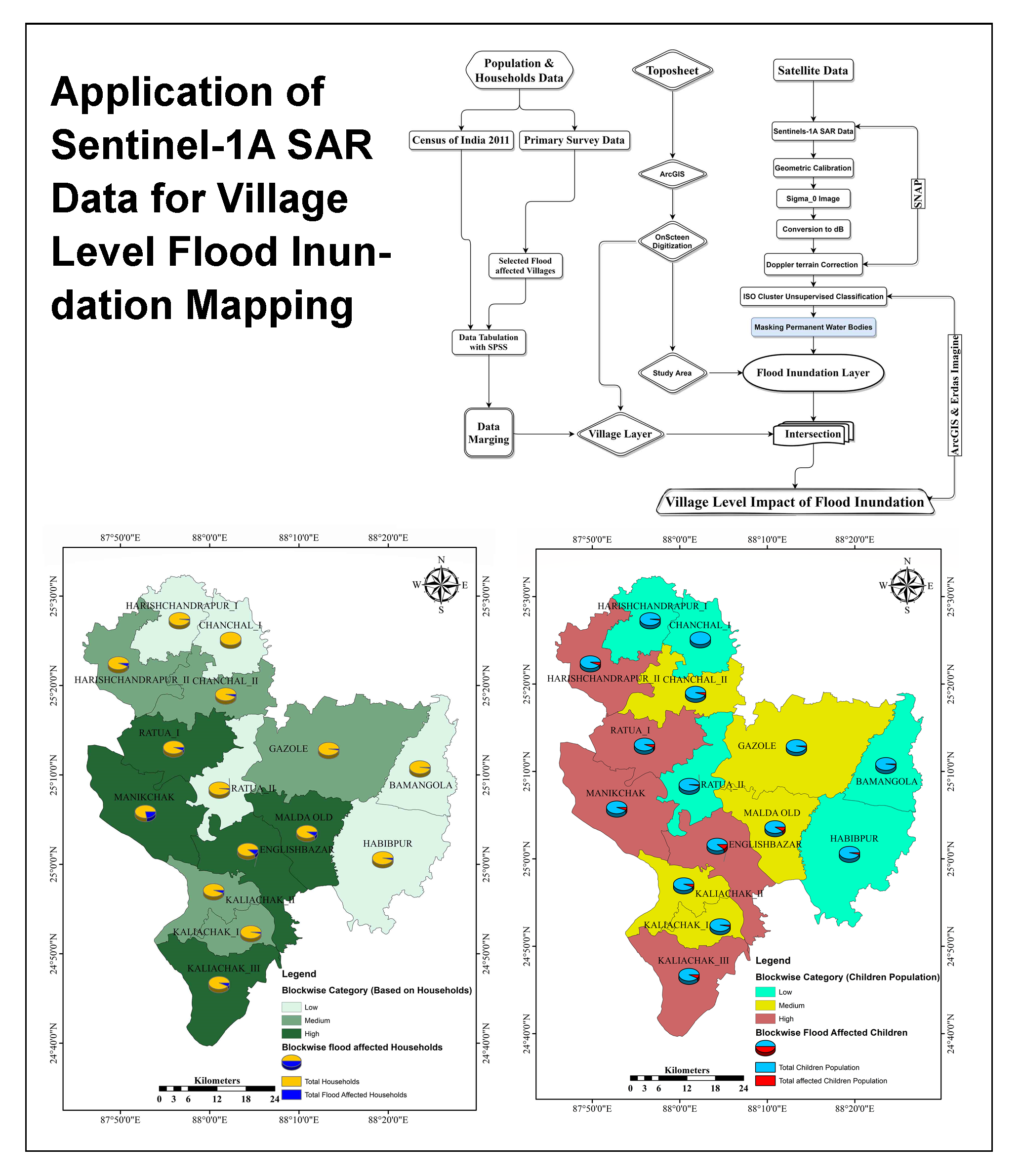
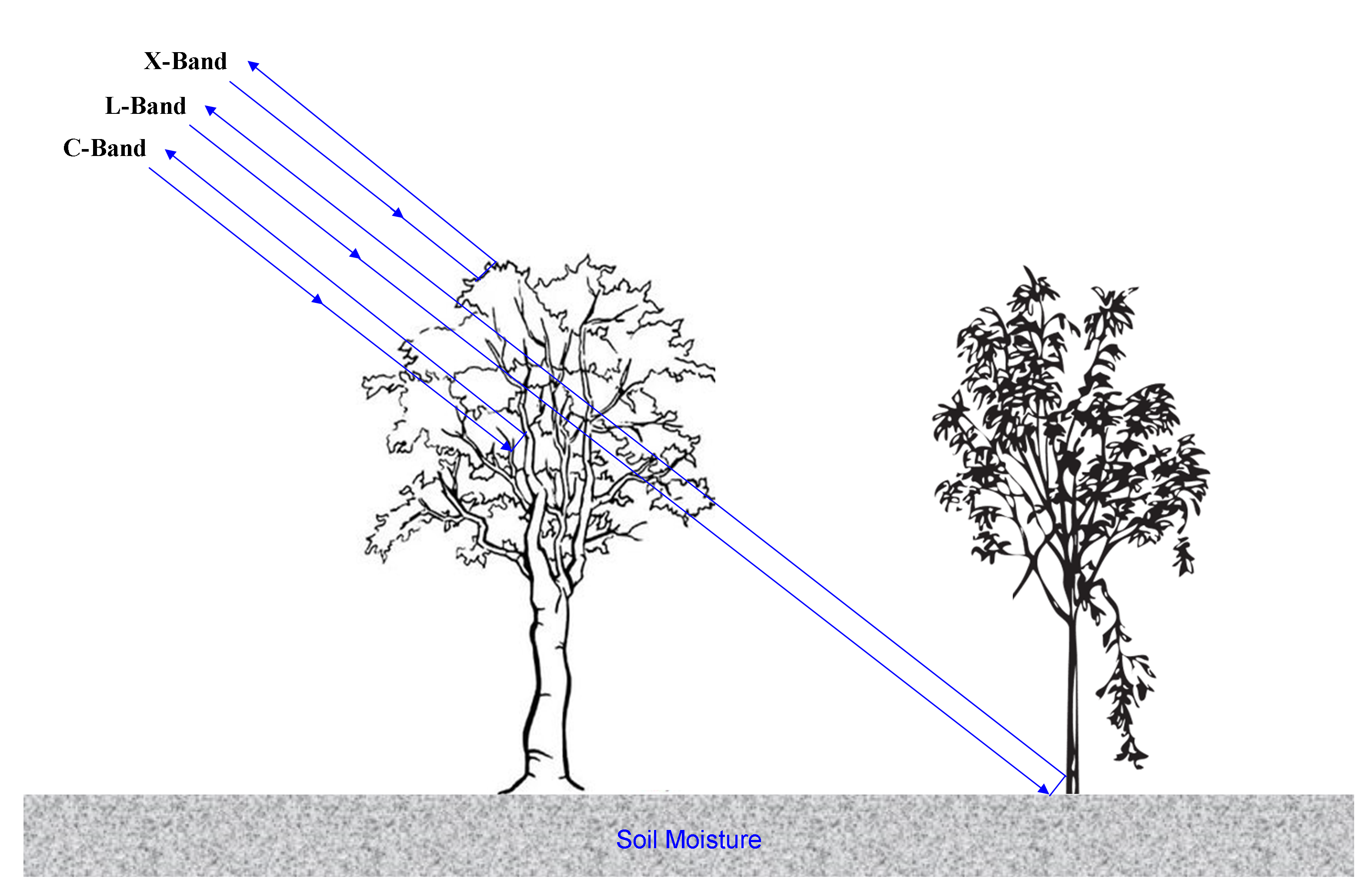
The flood inundated area and land mass were separated based on the backscatter value of SAR data.
About 380.19 km² on 4th sept 2019 and 338.87 km² on 7th sept 2019 areas were immediately impacted by the flood.
The delineated inundation layer intersected with the village-level database.
About 766 (42.81%) villages were highly impacted with 51610 households.
The children were highly impacted during the floods due to high dependency.
Attema, E., Bargellini, P., Edwards, P., Levrini, G., Lokas, S., Moeller, L., Rosich-Tell, B., Secchi, P., Torres, R., Davidson, M. and Snoeij, P., 2007. The radar mission for GMES operational land and sea services. European Space Agency Bulletin, 131, 10-17.
Ismail, M. and Mustaquim, M., 2013. Socio-economic status of population in flood prone areas of Chanchal sub-division in Malda District, West Bengal. International Journal of Research in Applied, Natural and Social Sciences, 1(3), 141-152.
Kumar, A. R. and Raghav, A. A., 2018. A Case study on the flood situation of Assam State. International Research Journal of Engineering and Technology (IRJET), 5(5), 4192-4194.
Rahman, M. R., 2006. Flood inundation mapping and damage assessment using multi-temporal RADARSAT and IRS 1C. Asian Journal of Geoinformatics, 6(2), 1-11.