1 . INTRODUCTION
Water is a priceless natural resource that is necessary for environmental protection, social and economic progress, food production, and human health. Due to causes including population expansion, economic development, social unrest, environmental degradation, the consequences of climate change, and technological breakthroughs, there is a severe strain on the world's water supplies in many areas (Sayl et al., 2020). Water scarcity is a major issue brought on by changing hydrological phenomena and rising water demand across all sectors (Prasad et al., 2014). The world's need for water is growing over time as a result of rapid population growth and rising agricultural and domestic demands. Beyond the absence of rain and its unpredictable spatial and temporal pattern, these stresses exist. Rainfall is the only significant source that can significantly reduce this issue (Arnab et al., 2018). To increase the water level for watershed management, finding suitable places for water harvesting is essential (Arnab et al., 2018).
Due to population expansion, groundwater mining, and climate change, there is more global demand for water resources (Kumar, 2019). Water demand includes a sizeable portion of domestic and agricultural water use. To fulfill this expanding demand, it has been discovered that rainwater harvesting (RWH) provides a practical alternative (Arjita et al., 2017). In general, a low-cost method can be utilized to identify locations that are suited for RWH through the use of Geographic Information Systems (GIS) data (Sayl et al., 2020). RWH has the potential to be an inexpensive and sustainable choice for the underprivileged who have little access to groundwater when backed by a market-based strategy (Al-shabeeb, 2016).
Ethiopia has suffered from repeated drought scenarios in the past (Binyam and Desale, 2015); especially the peripheries of the country like the Genale-Dawa basin are more prone to drought than the interior highlands (Getachew et al., 2020). Even significant surface water sources are exhausted during the driest seasons, leaving enormous tracts of land that would be ideal for irrigation uncultivated and occasionally reducing the availability of conventional home water supplies (Tsegay and Woldegebriel, 2017). Proper management and utilization of water resources are vital in the region (Berhanu and Bisrat, 2018). Small land holder farmers in Ethiopia are constrained in their ability to produce crops by a lack of rain and its variability, and climate change could make matters worse (Berhanu and Bisrat, 2018). Water harvesting is a desirable strategy for addressing this. The gathering, storing, and accumulation of rainwater is known as rainwater harvesting (RWH) (Negash et al., 2022). Rainwater harvesting has been practiced for over 4000 years throughout the world, traditionally in arid and semi-arid areas, and has provided drinking water, domestic water, and water for livestock and small irrigation (Binyam and Desale, 2015). Today, rainwater harvesting has gained much significance as a modern, water-saving, and simple technology (Khudhair et al., 2020). To increase and maintain agricultural output, especially in regions with irregular and unequal rainfall distribution, rainwater harvesting is essential (Ranim et al., 2016). RWH is not just a potential source of water for people in underdeveloped countries, but also for people in rich ones. The usage of RWH will surely expand as freshwater resources around the world become more contaminated and depleted, endangering sustainable development and the health of people and ecosystems.
The identification of acceptable rainwater harvesting sites is a difficult task (Endalkachew et al., 2020). The choice of appropriate locations for rainwater collection in sizable areas is a difficult task. Many data, including those related to hydrology, soil, climate, topography, agronomy and socioeconomics, must be collected and extracted for site selection (Getachew et al., 2020). Taking all these criteria into consideration in the site selection process may be difficult and time-consuming (Khudhair et al., 2020). As a result, a variety of approaches have been utilized to choose suitable sites. The most popular way for selecting possible RWH locations is AHP (Al-shabeeb, 2016). The AHP technique organizes and analyzes difficult decisions in a structured manner based on the knowledge of experts. When used in conjunction with AHP, Geographic Information Systems (GIS) and Remote Sensing (RS) can be used to pinpoint locations in a basin where rainwater harvesting (RWH) has the potential to be a cost-effective and sustainable solution for the underprivileged who have limited access to groundwater (Al-shabeeb, 2016). GIS plays a key role in maintaining data and analyzing optimal locations (Kumar, 2019). GIS is a tool that reduces the time and cost of site selection and provides digital data for future monitoring of the selected sites (Sayl et al., 2020). GIS environmental uses multi-criteria decision analysis (MCDA) to integrate spatial data layers representing the criterion and to indicate how the layers are mixed. The Analytical Hierarchy Process (AHP) an MCDA technique used in GIS, establishes weights for the chosen criteria. Analytical Hierarchy Process (AHP) is an effective method in multiple decision-making processes using in many fields such as finance, business, education, politics and engineering. Among the multi-criteria decision-making methods (MCDM) the most commonly used method is the AHP, which was developed by (Saaty, 1980). The AHP has been reconstructed by many researchers because of its several advantages in making critical decisions. The AHP is a flexible mathematical model considering the priorities of the individual or group and evaluates both quantitative and qualitative criteria in decision-making problems (Saaty, 1994). One of the advantages of the AHP method is its extensibility and robustness; if the decision maker wishes, he can modify the value of a criterion or add or eliminate criteria that he deems relevant. The method allows him to readjust the evaluation previously carried out without repeating the entire hierarchy already established
Several studies have examined the use of GIS for choosing the best locations for water harvesting projects, but few have focused on our country Ethiopia or the research region (Binyam and Desale, 2015; Endalkachew et al., 2020; Getachew et al., 2020; Negash et al., 2022; Tasisa et al., 2020; Tsegay and Woldegebriel, 2017). Therefore, the objective of this study was to identify rainwater harvesting potential sites for sustainable development in drought-prone areas of the Genale Dawa river basin using geospatial and multi-criteria decision analysis (MCDA) approach.
2 . MATERIALS AND METHODS
2.1 Study Area
Genale Dawa river basin lies in the southern part of Ethiopia, covering parts of Oromia, SNNP, and Somali regions (Figure 1). Geographically located between 3˚30' and 7˚20' North latitude and 37˚05' and 43˚20' East longitude (Girma, 2021). The basin covers an area of 172889 km2. It is the third-largest river basin, after Wabi Shebelle and Abbay river basins. Neighboring river basins are the Wabi Shebelle to the north and east, and the Rift Valley basin to the west. The basin falls mainly in the arid and semi-arid zone and is generally drought-prone with erratic rainfall of an average annual rainfall spatial variation ranging from 232mm to 1705mm. The easterly and southeasterly moist air currents ascend over the highlands in spring, produce the main rainy season in southern Ethiopia in general, and in the Genale Dawa basin in particular and bring ‘small rains’ of spring (March to May) to most parts of the country. Southeast (Genale Dawa river basin), therefore, gets its first maxima rainfall during spring and receives the year’s secondary maxima rainfall during autumn from the Indian Ocean easterlies. While the basin receives little rainfall in summer compared to spring (March to May) and autumn (September to November) due to the case that the Southerly Indian Ocean air currents lie in the lee side of the highlands in summer and Atlantic westerly's reach the southeastern lowlands (Genale Dawa) after losing their moisture on the highlands to the west. Physiographical the Genale Dawa basin is characterized by low relief tabular plateau made of Mesozoic sediments separated by deep river incisions. The geology of the Genale-Dawa River Basin was categorized into four major divisions. These are (i) Precambrian crystalline basement, (ii) Late Paleozoic to Mesozoic sedimentary successions, (iii) Tertiary volcanic successions, and (iv) Quaternary volcanic rocks and unconsolidated alluvial deposits.
2.2 Data
Site selection for rain water harvesting requires considering different factors and balancing several objectives to determine a suitable site. The selection of RWH-suitable locations integrates social, economic, and physical criteria. In the present study, remote sensing data (Landsat satellite imagery), digital evaluation models (DEM), soil type maps, and rainfall data were adapted to be used for the identification of water harvesting sites. A Landsat image was used to detect the land use/cover maps. The Landsat 8 Operational Land Imager (OLI) data were obtained from the United States Geological Survey (USGS) website. It was taken in October 2020 with a 30m resolution. The drainage density, slope, and topographic maps were generated using DEM. The soil map of the study area was obtained from the Ministry of Irrigation and Water Resources of Ethiopia. The soil map is defined by the texture, and depth of the soil in the study area. The rainfall data were delivered by the institute of the meteorology of Ethiopia for the years 1991 to 2021 as measured by the 20 meteorological stations in the study area.
2.3 Methods
Identification of rainwater harvesting sites is a complex process that calls for a comprehensive examination of several variables, with environmental considerations playing a major role. Hence, the primary environmental factors taken into account in this study (Figure 2): Land use land cover, slope, soil data (texture and depth), rainfall, drainage density, and distance from the road. Data collected from desired sources were analyzed using the applications of various ArcGIS toolsets of the ArcGIS toolbox based on the nature of the analysis. Accordingly, LULC was acquired from Landsat imageries and held analysis including pre-processing to actual classifications using maximum likelihood classification algorithm followed by a reclassification system. Slope and drainage density which were extracted from DEM data were analyzed using surface analysis of the spatial analyst toolbox. Euclidean distance function embodied in the spatial analyst toolbox was used to calculate the distance to the roadway. Soil data was also proceeded through a rasterization process to get the texture and depth-based soil criteria maps. The rainfall data were also collected from meteorological stations and an interpolation technique (IDW) was applied followed by classification and reclassification systems. Having analysis of each criteria map, they were integrated and compared using a pairwise comparison technique followed by weighted overlay analysis using a raster calculator. The socioeconomic data collected from observations, questionnaires, and interviews, on the other hand, were also analyzed statistically providing supporting information for the environmental parameters dependent integrated output.
3 . RESULTS AND DISCUSSION
3.1 Analysis of Thematic Layers
The layers chosen for this research were determined based on the geophysical characteristics of the study area and the literature on selecting appropriate RWH sites. In this study, the following significant criteria were chosen to locate the basin's eligible RWH sites: slope, soil depth, soil texture, rainfall, drainage density, LULC, and distance from road. All primary and secondary data used were preprocessed and resampled to a constant 30 X 30 meter resolution. To prevent the model's factors from becoming redundant, the correlation coefficient matrix between each factor was computed. All of the correlation coefficient values were close to zero, indicating that none of the factors are connected and are therefore suitable for the modeling.
3.1.1 Land Use Land Cover
Land-use land-cover (LULC) was extracted from Landsat 8 OLI Satellite Imagery, using ERDAS Imagine 2015 software to preprocess and classify the image. Different LULC classes were applied through supervised classification, with a combination of three consecutive bands as false color composite (FCC) of band 3, band 4, and band 5. Images and maps such as reference and topographic maps, Google Earth, and world land-cover images were used to define detailed training sites. Bare lands and cultivated lands were rated in the high suitability class, for their suitability for most types of RWH technologies whereas settlements and forests were rated low, for their unsuitable and uneconomical nature (Endalkachew et al., 2020) (Table 1). This newly categorized, reclassified and standardized LULC layer (Figure 3) was used for further analysis. The distribution of LULC in the research region was split into five groups for rainwater harvesting. The area was classified into the following categories: extremely suitable (0.86%), very suitable (49.4%), moderately suitable (36.1%), marginally suitable (13.5%), and not suitable (0.03%), respectively.
Table 1. Land use land-cover
|
Types
|
Rate
|
Classes
|
Area (km2)
|
|
Settlement
|
1
|
Not suitable
|
57
|
|
Forest
|
2
|
Less suitable
|
23411
|
|
Shrub land
|
3
|
Suitable
|
62496
|
|
Agricultural land
|
4
|
Very suitable
|
85438
|
|
Bare land
|
5
|
Extremely suitable
|
1487
|
3.1.2 Soil Texture
The soil texture of the study area was classified based on the importance of soil characteristics in the determination of land surface for RWH, which determines water infiltration rate and water storage in the soil (Figure 3). Fine and medium textured soils are generally the more desirable for RWH because of their superior retention of nutrients and water (Kumar, 2019). Soils with a high percentage of clay particles were rated high (Endalkachew et al., 2020), which has a higher water-holding capacity, and area with soils having a minimum percentage of clay was rated low concerning higher infiltration rate (Table 2). The distribution of soil texture in the research region was categorized into five groups for the purpose of rainwater harvesting. As a result, 35.63% of the area was determined to be extremely suitable, 0.004% of the area was determined to be highly suitable, 20.97% of the area was determined to be moderately suitable, and the remaining 24.55% and 18.85% of the area were determined to be marginally suitable and not suitable, respectively.
Table 2. Soil texture
|
Classes
|
Rate
|
Classes
|
Area (km2)
|
|
Sand, loamy sand
|
1
|
Not Suitable
|
32582
|
|
Sandy loam
|
2
|
Less Suitable
|
42443
|
|
Loam
|
3
|
Suitable
|
36253
|
|
Sandy clay loam
|
4
|
Very Suitable
|
6
|
|
Clay
|
5
|
Extremely Suitable
|
61603
|
3.1.3 Slope
ArcGIS software was used to create a slope map using the SRTM DEM. The SRTM DEM was used to produce a slope map with the GIS environment. The study area has a wide range of slopes, from flat to quite mountainous. Figure 3 shows five categories of slope percentage are distinguished: extremely suitable (0–2%), highly suitable (2–5%), moderately suitable (5–10%), marginally suitable (10–30%), and not suitable (>30%). When selecting and implementing RWH sites, the slope is one of the most crucial considerations since it affects surface water runoff, recharge, and flow (Tsegay and Woldegebriel, 2017). The distribution of the slope in the study area was divided into five classes. Accordingly, 50.4% of the area was extremely suitable, 28.9% of the area was classified as highly suitable, 13.3% of the area was moderately suitable, and the remaining 7.3% and 0.11% of the area was marginally suitable and not suitable, respectively (Table 3).
Table 3. Slope
| Slope (%) |
Rate
|
Classes
|
Area (km2)
|
|
S > 30
|
1
|
Not suitable
|
189
|
|
10 - 30
|
2
|
Less suitable
|
12617
|
|
5 - 10
|
3
|
Suitable
|
22964
|
|
2 - 5
|
4
|
Very suitable
|
49912
|
|
S < 2
|
5
|
Extremely suitable
|
87204
|
3.1.4 Rainfall
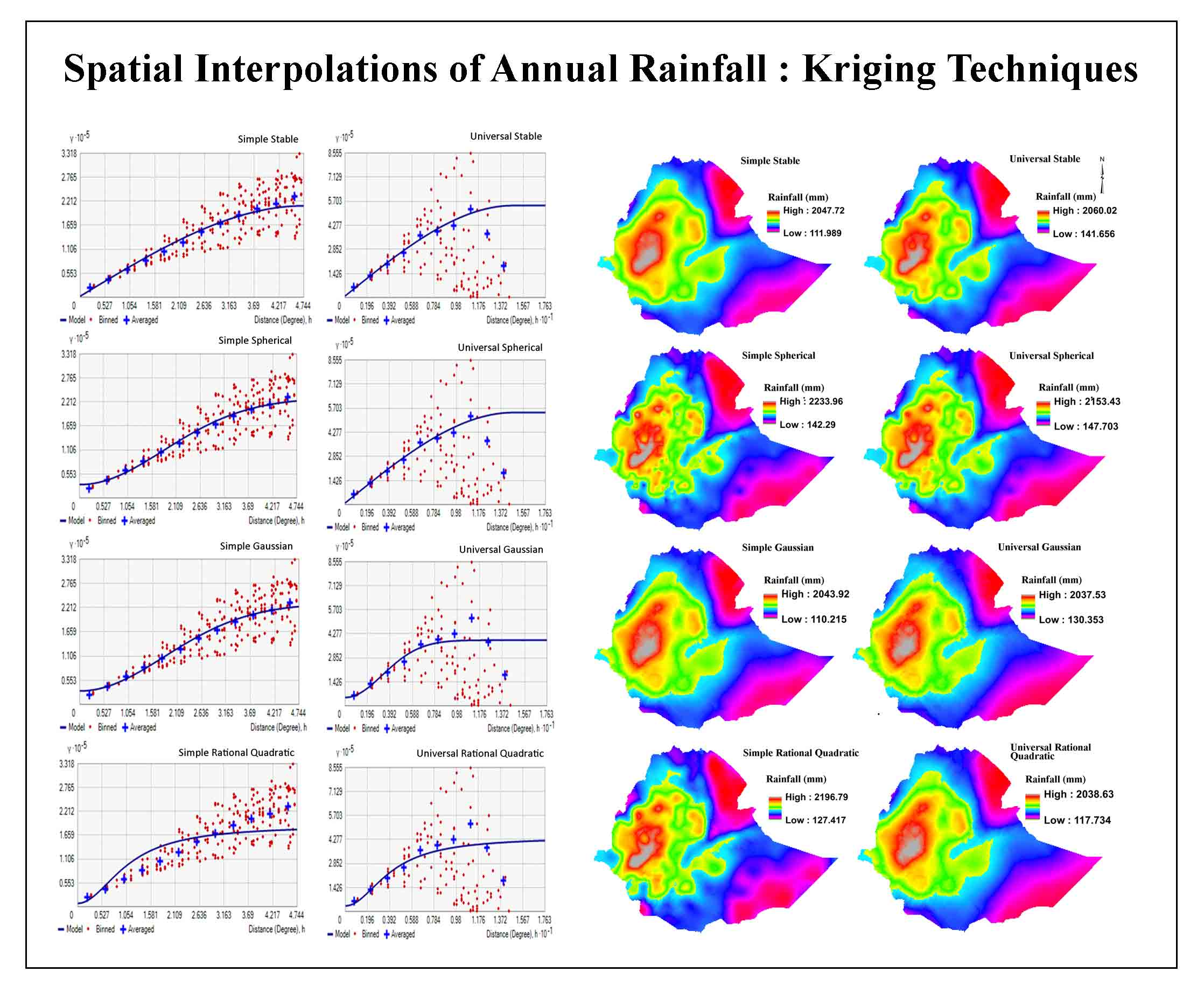
The highest weighted factor for choosing a suitable site for rainwater harvesting is rainfall. The precipitation data were analyzed over 30 years (1991–2021) from 20 metrological stations. The inverse distance weight (IDW) spatial interpolation technique was used to estimate the precipitation for areas that do not have precipitation measurements, and the interpolated result showed that the study area receives precipitation from 232.1 to 1706mm (Figure 3). For rainwater harvesting, the distribution of precipitation in the study area was divided into five classes. As shown in (Table 4), 13.7% of the area was extremely suitable, 21.7% of the area was classified as highly suitable, 37.2% of the area was moderately suitable, and the remaining 7.7% and 19.6% of the area was marginally suitable and not suitable, respectively.
Table 4. Rainfall
|
Rainfall (mm)
|
Rate
|
Classes
|
Area (km2)
|
|
232-492
|
1
|
Not suitable
|
33945
|
|
492-723
|
2
|
Less suitable
|
13427
|
|
723-914
|
3
|
Suitable
|
64290
|
|
914-1145
|
4
|
Very suitable
|
37570
|
|
1146-1706
|
5
|
Extremely suitable
|
23655
|
3.1.5 Drainage density
Standardized reclassification of the drainage density layer was done based on the length of streams present in each basin area (Table 5). Potential rainwater harvesting site selection is more dependent on the density of drainage present in a given area, especially in areas where irrigation-led agricultural activities are common (Endalkachew et al., 2020). An area with high drainage density was rated higher in suitability for RWH site compared to areas of low drainage density (Figure 3). For rainwater harvesting, the distribution of drainage density in the study area was divided into five classes. Accordingly, 2.9% of the area was extremely suitable, 6.4% of the area was classified as highly suitable, 13% of the area was moderately suitable, and the remaining 24% and 53% of the area were marginally suitable and not suitable, respectively.
Table 5. Drainage density
| Drainage density (km/km2) |
Rate
|
Classes
|
Area (km2)
|
|
0.000 - 0.022
|
1
|
Not suitable
|
91963
|
|
0.023 - 0.067
|
2
|
Less suitable
|
41806
|
|
0.068 - 0.120
|
3
|
Suitable
|
23030
|
|
0.130 - 0.170
|
4
|
Very suitable
|
11113
|
|
0.180 - 0.290
|
5
|
Extremely suitable
|
4974
|
3.1.6 Distance from Roads
Rainwater harvesting sites should be far enough away and located from roads and settlements. When the RWH structure is constructed near to road and settlement, in some cases the rainwater harvesting reservoirs may generate flood to nearby areas as well as the farmer may be prone to waterborne disease (Arjita et al., 2017). Therefore, rainwater harvesting structures should be constructed away from the road and settlement (Prasad., 2014). Euclidean distance function (Figure 6) is used to calculate the distance to roadways, with values ranging from 0 to 0.5km. The distribution of distance from the road in the study area was divided into five classes (Table 6). Accordingly, 3.4% of the area was extremely suitable, 8.22% of the area was classified as highly suitable, 17.8% of the area was moderately suitable and the remaining 27.8% and 42.8% of the area was marginally suitable and not suitable, respectively.
Table 6. Distance from roads
|
Distance (km)
|
Rate
|
Classes
|
Area (km2)
|
|
0-048
|
1
|
Not Suitable
|
73976
|
|
0.049-0.11
|
2
|
Less Suitable
|
48026
|
|
0.12-0.19
|
3
|
Suitable
|
30737
|
|
0.2-0.3
|
4
|
Very Suitable
|
14216
|
|
>0.3
|
5
|
Extremely Suitable
|
4974.6
|
3.1.7 Soil Depth
Soil depth ensures proper root development and storage of harvested water; this suggests that deeper soil is suitable for collecting rainwater. Soil depth in the study area varies from 10 to 150 cm (Figure 4). Based on soil depth suitability, 40.4% were extremely suitable, 27.8% were highly suitable, 18. 8% were moderately suitable and 13% were classified as marginally suitable for rainwater harvesting (Table 7).
Table 7. Soils
|
Soil depth (cm)
|
Rate
|
Classes
|
Area (km2)
|
|
10
|
2
|
Marginally suitable
|
22471
|
|
50
|
3
|
Moderately suitable
|
32539
|
|
100
|
4
|
Highly suitable
|
48116
|
|
150
|
5
|
Extremely suitable
|
69761
|
3.2 Pairwise Comparison
Selecting criteria and options for decisions is a part of the MCDA. The importance of several criteria varies while selecting possible locations for rainwater harvesting. As a result, various factors were given varying weights. The analytical hierarchy process (AHP), also known as a pairwise comparison, can be used to achieve this. Each factor is compared to another factor using the pairwise comparison method. The AHP pairwise comparison matrix approach is used to calculate the weights for each criterion. Analytical Hierarchy Process (AHP) pairwise matrix is used to calculate the weights of each criterion by using ranking values from 1 to 9 (Saaty, 1994). In the first stage, criteria weights are calculated with a pairwise matrix via AHP by specifying the importance of each criterion to another. The sum of the weights must be equal to 1. The pairwise comparison square matrix is defined for the main- criteria and sub-criteria to determine the weights. The consistency of the pairwise comparison matrix must be calculated to decide the criteria, comparisons are consistent or not (Saaty 1980). The assigned preference values are synthesized to determine a ranking of the relevant factors in terms of a numerical value that is equivalent to the weights of each parameter. Therefore, the eigenvalues and eigenvectors of the square pairwise comparison matrix, revealing important details about patterns in the data matrix are calculated. The consistency index (CI) is one of the methods to define the consistency coefficient of the pairwise comparison matrix.
Table 8. Pairwise comparison matrixes
|
|
Slope
|
Rainfall
|
LULC
|
Soil texture
|
Soil depth
|
Distance to road
|
Drainage density
|
|
Slope
|
1
|
3
|
3
|
5
|
7
|
7
|
7
|
|
Rainfall
|
0.33
|
1
|
3
|
2
|
5
|
5
|
7
|
|
LULC
|
0.33
|
0.33
|
1
|
2
|
3
|
5
|
7
|
|
Soil texture
|
0.2
|
0.5
|
0.5
|
1
|
2
|
5
|
3
|
|
Soil depth
|
0.14
|
0.2
|
0.33
|
0.5
|
1
|
5
|
3
|
|
Distance to road
|
0.14
|
0.2
|
0.2
|
0.2
|
0.2
|
1
|
3
|
|
Drainage density
|
0.14
|
0.14
|
0.14
|
0.33
|
0.33
|
0.33
|
1
|
|
Sum
|
2.3
|
5.38
|
8.18
|
11.033
|
18.533
|
28.33
|
31
|
Table 9. Normalized pairwise matrix
|
|
Slope
|
Rainfall
|
LULC
|
Soil texture
|
Soil depth
|
Distance to road
|
Drainage density
|
|
Slope
|
0.44
|
0.56
|
0.37
|
0.45
|
0.38
|
0.25
|
0.23
|
|
Rainfall
|
0.15
|
0.19
|
0.37
|
0.18
|
0.27
|
0.18
|
0.23
|
|
LULC
|
0.15
|
0.06
|
0.12
|
0.18
|
0.16
|
0.18
|
0.23
|
|
Soil texture
|
0.09
|
0.09
|
0.06
|
0.09
|
0.11
|
0.18
|
0.1
|
|
Soil depth
|
0.06
|
0.04
|
0.04
|
0.05
|
0.054
|
0.18
|
0.1
|
|
Distance to road
|
0.06
|
0.04
|
0.02
|
0.02
|
0.011
|
0.04
|
0.1
|
|
Drainage density
|
0.06
|
0.03
|
0.02
|
0.03
|
0.018
|
0.01
|
0.03
|
|
Sum
|
1
|
1
|
1
|
1
|
1
|
1
|
1
|
Table 10. Determined relative weights
|
|
Slope
|
Rainfall
|
LULC
|
Soil texture
|
Soil depth
|
Distance to road
|
Drainage density
|
Weight
|
W(%)
|
|
Slope
|
0.44
|
0.56
|
0.37
|
0.45
|
0.378
|
0.25
|
0.23
|
0.38
|
38.1
|
|
Rainfall
|
0.15
|
0.19
|
0.37
|
0.18
|
0.27
|
0.18
|
0.23
|
0.22
|
22.2
|
|
LULC
|
0.15
|
0.06
|
0.12
|
0.18
|
0.162
|
0.18
|
0.23
|
0.15
|
15.4
|
|
Soil texture
|
0.09
|
0.09
|
0.06
|
0.09
|
0.108
|
0.18
|
0.1
|
0.10
|
10.2
|
|
Soil depth
|
0.06
|
0.04
|
0.04
|
0.05
|
0.054
|
0.18
|
0.1
|
0.07
|
7.33
|
|
Distance to road
|
0.06
|
0.04
|
0.02
|
0.02
|
0.011
|
0.04
|
0.1
|
0.04
|
4.07
|
|
Drainage density
|
0.06
|
0.03
|
0.02
|
0.03
|
0.018
|
0.01
|
0.03
|
0.03
|
2.84
|
|
Sum
|
1
|
1
|
1
|
1
|
1
|
1
|
1
|
1
|
100
|
3.3 Rainwater Harvesting Potentials
The study took into account the following RWH-appropriate criteria: LULC, rainfall, soil depths, slope, drainage density, and distance from the road. Potential RWH site suitability areas were found in the research area's spatial extents using an AHP analysis that considered a variety of physical layers. Based on weighted overlay analysis (WOA) of aggregate suitability index values, all the variables were combined to create a map showing RWH suitability classes (Figure 5). The prospective RWH sites as they have been found reflect precise levels of parameter appropriateness and the relative importance of various elements used in the investigation. The total water harvesting potential site was then calculated by using the raster calculator to multiply each factor map by the following eigenvector weight values:
\(RWH=0.38*[Slope]+0.22*[Rainfall]+0.15*[LULC]+0.1*[Soil \ teture]\)
\(+0.03*[drainage\ density]+0.07*[Soil\ depth]+0.05*[Distance\ to\ road]\)
Five comparable units used as a class for a potential site for RWH are: extremely suitable, highly suitable, moderately suitable, marginally suitable, and not suitable. From the total area (172888.6 km2) of the basin, the result of the study indicates that 19706.5km2) (11.4%) is extremely suitable, 84704 km2) (49%) is highly suitable, 59034 km2) (34.1%) is moderately suitable, 19411.2 km2) (5.44%) is marginally suitable and 32.746 km2) (0.02%) is not suitable for RWH. Our results are similar to the findings of Endalkachew et al. (2020), Tsegay and Woldegebriel (2017), Getachew et al. (2020).
The Eastern, Northern, Northeastern, Southwestern, and Central regions of the study area fall under extremely suitable to moderately suitable (Figure 5). Seldom, if ever, do portions of the research area fall into the non-suitability category. In contrast to them, a handful of the study area's northern, central, and western regions have moderately appropriate places.
Our findings show that a huge percentage of the study area falls into the category of suitability (extremely highly, moderately, and marginally), whereas a negligible portion is labeled as unsuitable. According to statistics, 11.4%, 49%, 34.1%, and 5.44% of the study area are extremely, highly, moderately, and marginally acceptable, respectively. The remaining 0.02% falls within the inappropriate class. The total for the suitable classes adds up to 99.98%, which is substantially greater than the percentage for the unsuitable classes. This shows that taking into account the indicated parameters (slope, soil texture, soil depth, land use/cover, rainfall, drainage density, and distance from roads and settlements), a significant portion of the research region is suitable for the creation of rainwater harvesting sites. The investigation categorized the administrative zones in the Genale Dawa river basin into various levels of suitability for rainwater harvesting. Accordingly, most parts of the Borena, Liben, and Dawa zones had extremely to highly suitable sites for rainwater harvesting. Afder, Bale, East Bale, Guji, and West Guji zones had moderately to a highly suitable sites for rainwater harvesting. The remaining zones include West Arsi, Gedeo, and Sidama had marginally to a moderately suitable sites for rainwater harvesting.
4 . CONCLUSIONS
In this study, potential suitable site for rainwater harvesting were found using remote sensing and geographic information system approaches coupled with AHP. The following significant criteria were chosen to locate the basin's eligible RWH sites: slope, soil depth, soil texture, rainfall, drainage density, (LULC), and distance from road. The Weighted overlay analysis (WOA) technique was used to identify the potential sites for water harvesting in the study area. This method is based on the collection of all the criteria after multiplying weights in rating, thereafter determining weights and unifying rating for each criterion. The study area was classified into five classes for rainwater harvesting extremely suitable, highly suitable, moderately suitable, marginally suitable, and not suitable. The large parts of the study area belong to a suitable class while an insignificant share is not suitable. Based on the aggregated suitability map: 11.4%, 49%, 34.1%, and 5.44% of the study area belongs to extremely suitable, highly suitable, moderately suitable, and marginally suitable classes while the remaining 0.02% is under the not suitable class. Since it identifies those places that are favorable for development, the study provides a significant benefit for the best possible development of rainwater harvesting sites. Also, it aids in guiding the future development of rainwater harvesting locations, simultaneously safeguarding other land uses. It can be concluded that rainwater harvesting, though needs initial investment, helps in conserving most precious gift from the nature, which is priceless and most valuable resource.


 ,
Gemechu Shuniye 1
,
Gemechu Shuniye 1