Article Title :
Multi-Criteria Watershed Prioritization of Kas Basin in Maharashtra India: AHP and Influence Approaches 
1 (2017)
41-61
Watershed , Prioritization , Ranking , Multi-criteria analysis , Correlation matrix , Weights , Influence , AHP


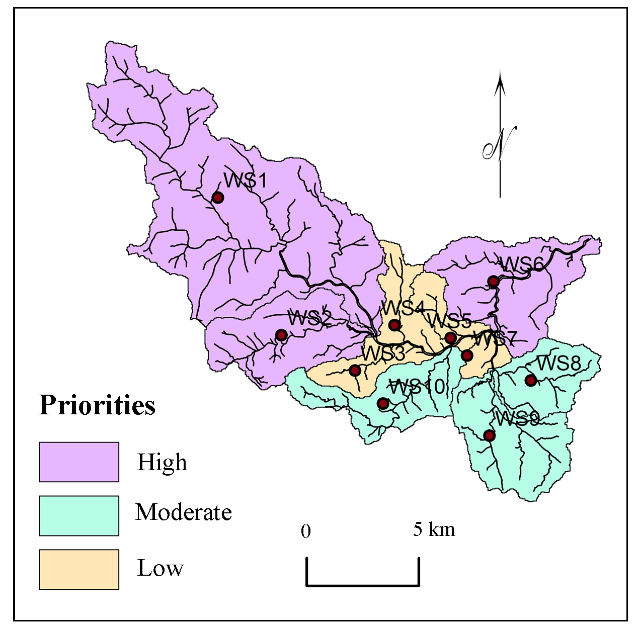
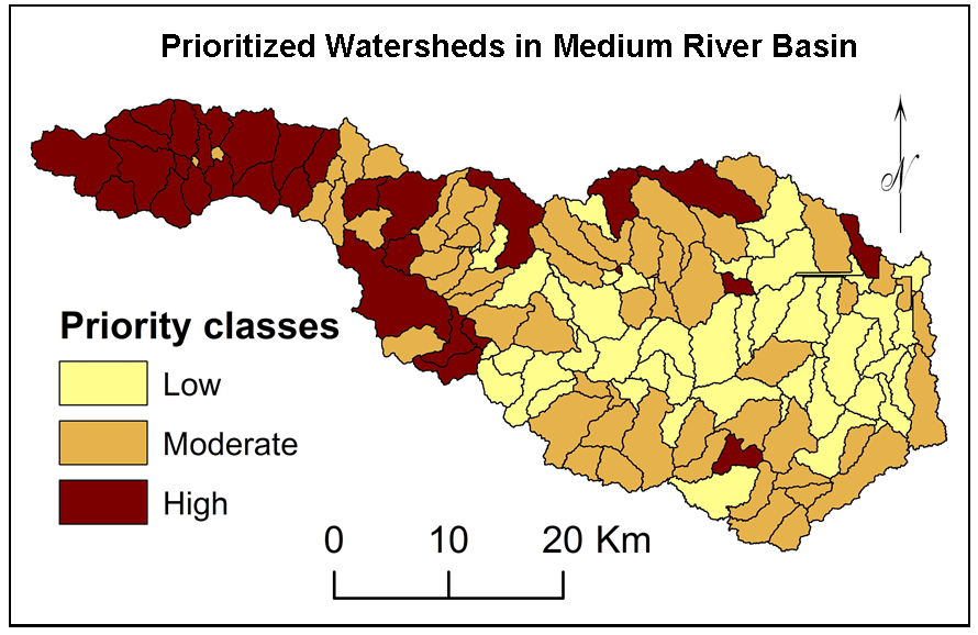
Watershed is unique bio-physical unit of the Earth’s surface and source of resources to the people. These resources are being exploited for various purposes. AHP based multi-criteria analysis is useful for prioritization of watersheds for planning, management and development. Nineteen criterion i.e. \(R_b\), \(L_b \), \(A\), \(L_b\), \(P\), \(D_d\), \(P\), \(F_s\), \(R_f\), \(R_e\), \(C_C\), \(D_t\), \(T\), \(D_i\), \(I_f\), \(R_{h1}\), \(R_n\) , slope and soils were selected for prioritization of sub-watersheds of Kas basin in Maharashtra (India). Correlation analysis suitable for robust judgment for ranking the criterion was used for prioritization of selected watersheds. Drainage intensity (27.80%), texture ratio (13.90%), bifurcation ratio (9.27%), geology (6.95%) and basin length (5.56%) show higher influence on formation of watershed structure in the region. Influences of criterion were estimated based on weights calculated using AHP techniques. Values of influences were normalized using distribution of selected criterion within the sub-watersheds. Watersheds were classified into three categories of priorities: high, moderate and low priorities. The methodology formulated in this study can be efficient tool for rapid prioritization of watersheds for planning and management for development.

AHP based multi-criteria analysis is useful for prioritization of watersheds.
Morphometric parameters, soil and geology were used for prioritization of watersheds.
Correlation analysis is useful for robust judgment for ranking the criterion.
Estimated influences were normalised using distribution of selected criterion.
Watersheds were classified into three categories of priorities: high, moderate and low priorities.
Chatterjee, A. and Tantubay, A., 2000. Morphometric analysis for evaluating groundwater potential zones, in Kusangai Jor Watershed Area, Dist. Bolangir, Orissa. Department of Geology, Presidency College, 86/1 College Street, Kolkata-700073, 1-6.
Corn, M. L., 1993. Ecosystems, Biomass, and Watersheds: Definitions and Use. Washington DC, National Council for Science and the Environment.
Gajbhiye, S., Sharma, S. K., Meshram, C., 2014. Prioritization of watershed through sediment yield index using RS and GIS approach. International Journal of u- and e- Service, Science and Technology, 7(6), 47-60.
Kaur, M., Singh, S., Verma, V. K. and Pateriya, B., 2014. Quantitative geomorphological analysis and land use/ land cover change detection of two sub-watersheds in Ne Region of Punjab, India. The International Archives of the Photogrammetry, Remote Sensing and Spatial Information Sciences, 49(8), 371-375.
Kedareswarudu, U., Aravind, U. S., Chattopadhyay, M., 2013. Analysis of watershed characteristics and basin management using RS and GIS: A case study from upper Provenance of Karamana river, Trivendrum district, Kerala. International Journal of Remote Sensing and Geoscience (IJRSG), 2(1), 36-48.
Li, Z.,Yong, F., Zeng, G., Li, J., Zhang, Q., Yuan, Q., Wang, Y., Ye, F., 2009. Temporal and spatial characteristics of surface water quality by an improved universal pollution index in red soil hilly region of South China: A case study in Liuyanghe River watershed. Environmental Geology, 58(01), 101-107.
Nagal, S., Tignath, S., Pandey, A., 2014. Morphometric analysis of the Adwa River Basin, tributary of Belan River, India. International Journal of Advanced Technology and Engineering Research, 4(2), 39-45.
Panhalkar, S., 2011. Land capability classification for integrated watershed development by applying Remote Sensing and GIS techniques. ARPN Journal of Agricultural and Biological Science, 6(4), 46-55.
Pokharkar, D. V., 2011. A study of watershed development programme in Sangamner taluka: A geographical analysis. Unpublished Ph.D. Thesis.
Ranjan, R., 2013. Saaty’s Analytical Hierarchical Process based prioritization of sub-watersheds of Bina River Basin using Remote Sensing and GIS. Thesis submitted to the Jawaharlal Nehru Krishi Vishwa Vidyalaya, Jabalpur, 3, 36-55.
Rockstrom, J., Folke, C., Gordon, L., Hatibu, N., Jewitt, G., Penning, de V. F., Rwehumbiza, F., Sally, H., Savenije, H. and Schulze, R., 2004. A watershed approach to upgrade rainfed agriculture in water scarce regions through Water System Innovations: An integrated research initiative on water for food and rural livelihoods in balance with ecosystem functions. Physics and Chemistry of the Earth, 29, 1109-1118.
Sharma, S. K., Tignath, S., Gajbhiye, S. and Patil, R., 2009. Application of principal component analysis in grouping geomorphic parameters of Uttela Watershed for Hydrological Modeling. International Journal of Remote Sensing and Geoscience, 2(6), 1629-1634.
Shinde, V., Tiwari, K. N. and Singh, M., 2010. Prioritization of micro watersheds on the basis of soil erosion hazard using Remote Sensing and geographic information system. International Journal of Water Resources and Environmental Engineering, 2(3), 130-136.
Strahler, A. N., 1957. Watershed geomorphology. Transactions - American Geophysical Union, 38(6), 913-920.
Strahler, A. N., 1964. Quantitative geomorphology of drainage basins and channel networks, in: Chow. V. T. (Ed.). Handbook of Applied Hydrology, Mc Graw-Hill, New York, 439-476.
Swallow, M. B., Johnson, N. L. and Meinzen Dick, R. S., 2001. Working with people for watershed management. Water Policy, 3, 449-455.
Wilson, J. S., J., Chandrashekhar, N. and Magesh, N. S., 2012. Morphometric analysis of major sub-watersheds in Aiyar and Karai Pottanar Basin, Central Tamil Nadu, India using Remote Sensing and GIS Techniques. Bonfring International Journal of Industrial Engineering and Management Science, 2(1), 8-15.
Yin, H., Udelhoven, T., Fensholt, R., Pflugmacher, D. and Hostert, P., 2012. How Normalized Difference Vegetation Index (NDVI) trends from Advanced Very High Resolution Radiometer (AVHRR) and Système Probatoire d’Observation de la Terre VEGETATION (SPOT VGT) time series differ in agricultural areas. An Inner Mongolian Case Study, Remote Sens., 4(11), 3364-3389.


