Article Title :
Analysis of Urban Expansion and Modeling of LULC Changes Using Geospatial Techniques: The Case of Adama City 
4 (2020)
40-58
Cellular Automata , GIS , Image Classification , LULC , Markov Chain , Modeling , Remote Sensing


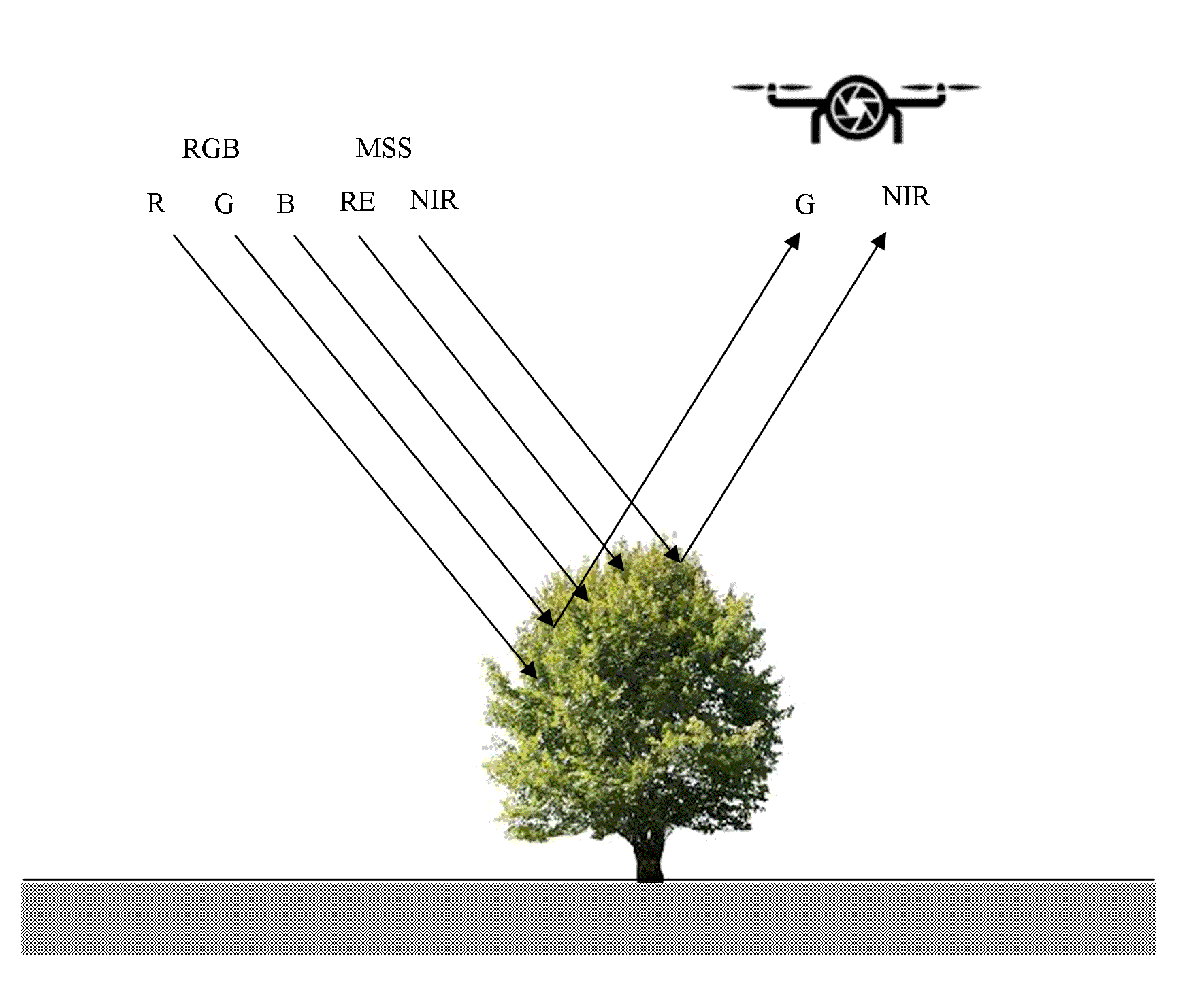
In the last decades, Adama city has experienced drastic changes in its shape, not just in its vast geographical expansion, but also by internal transformations. Subsequently, understanding and evaluating the spatiotemporal variability of urban land use and land cover (LULC) shifts, and it is important to bring forth the right strategies and processes to track population development in decision-making. The goal of this analysis was therefore to examine LULC changes that have taken place over 37 years, forecast the long-term urban development in Adama City using geospatial techniques. To attain this, satellite data of Landsat 1973, 2000 and 2010 was downloaded from USGS Earth Explorer and processed using Arc GIS 10.5, Erdas 9.2, and Idrisi 32. A supervised classification technique has been used to prepare the base maps with six land cover classes that are accustomed to generate LULC maps. The maps are cross-tabulated to measure LULC changes, to look at land-use transfers between the land cover classes, to spot increases and declines in built-up areas in comparison to other land cover classes, and to determine the spatial changes in built-up areas. Finally, Markov Chain and CA-Markov techniques were used to model the LULC changes in the Adama district and to forecast possible changes in urban land use. The model was verified by the Kappa statistics and also by the application of other validation techniques. The growth of built-up areas in the last 37 years has risen from 2% in 1973, 10% in 2000 and 23% in 2010 and estimated about 60% over the next 30 years (2040).
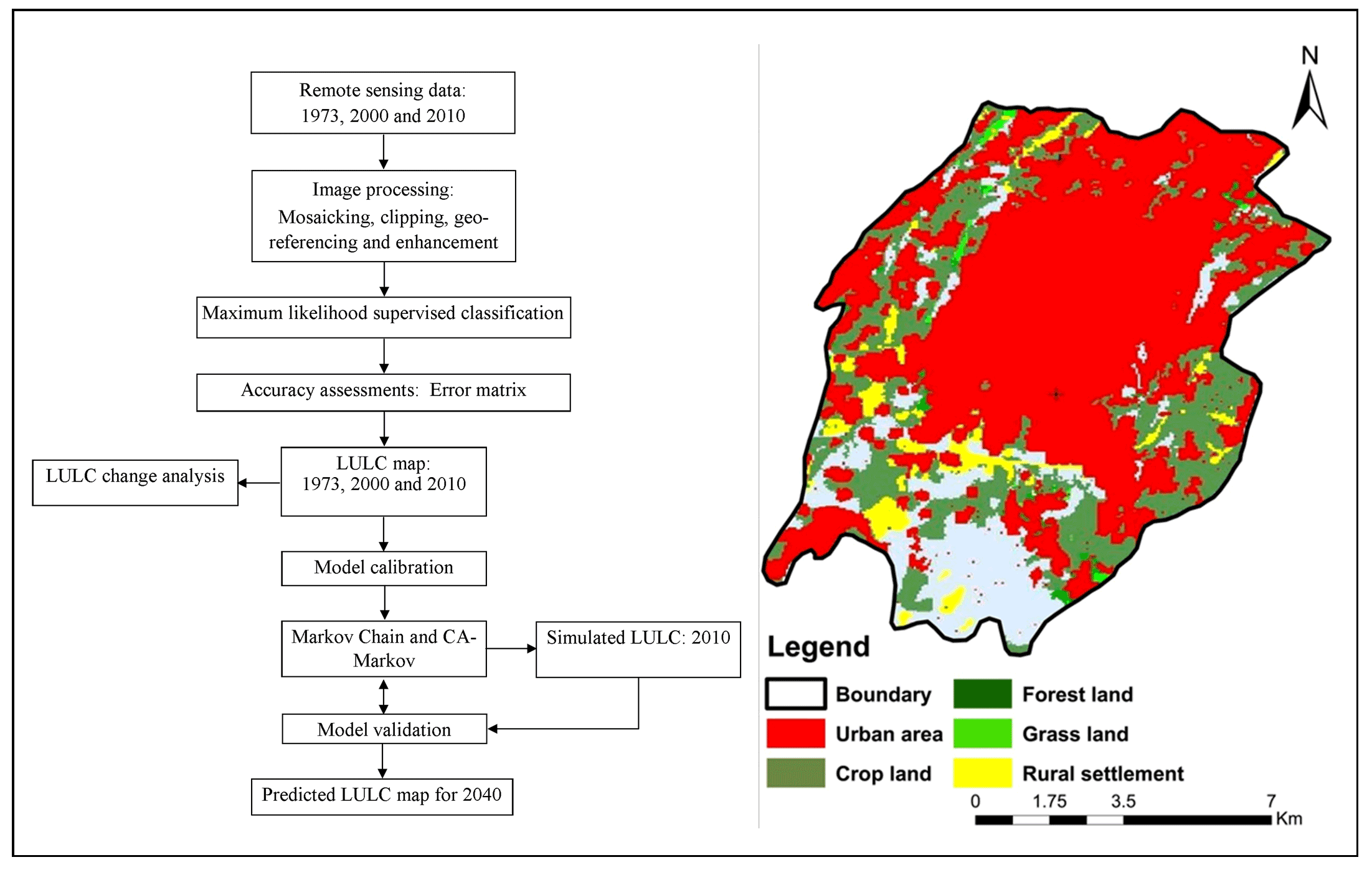
The study focused on examination of spatial changes in urban areas using geospatial technology.
Markov Chain and CA-Markov techniques were used to model the LULC changes in the Adama district.
The model was verified by the Kappa statistics and also by the application of other validation techniques.
The growth of built-up areas in the last 37 years has risen from 2% in 1973, 10% in 2000 and 23% in 2010.
The identified changes in urban patterns will be useful for successful land use regulations and planning.
Africover, 2002. Specifications for geometry and cartography: A summary report of the workshop on Africover.
Al-Shalabi, M. A., Bin Mansor, S., Bin Ahmed, N and Shiriff, R., 2006. GIS-based multi-criteria approaches housing site suitability assessment. In XXIII FIG Congress, shaping the change, Munich, Germany, October, 8-13.
APO, 2004, National regional state of Oromia Adama project office. Adama master plan revision project: a brief of Adama city.
Eastman, J. R., 2009. IDRISI Taiga guide to GIS and Image Processing (Manual Version 16.02) [Software] (Massachusetts, USA: Clark Labs, Clark University).
Herold, M., Menz, G. and Clarke, K. C., 2001. Remote sensing and urban growth models- demands and perspectives. In symposium on remote sensing of urban areas, Regensburg, Germany, Regensburger Geographische Schriften, 35.
IDRISI Taiga Help System, 2009. Clark Labs, Clark University, 950 Main Street, Worcester, MA01610-1477, USA.
Keil, R., 2018. Suburban Planet. Making the World Urban From the Outside, Polity Press, Medforg, MA, USA.
Mesev, V., 2008. Integration of GIS and Remote Sensing.Published by John Wiley and Sons.
Mesfin, T., 2009. Spatial metrics and Landsat data for urban land-use change detection in Addis Ababa, Ethiopia.
Messay, M., 2010. Food security attainment role of urban agriculture: A case study from Adama town, central Ethiopia.
Pinto, P., Cabral, P., Caetano, M and Alves, M. F., 2009. Urban growth on coastal erosion vulnerable stretches. Journal of Coastal Research, 2, 1567-1571.
Tadesse, W., Coleman, T. L, and Tsegaye, T. D., 2003. Improvement of land use and land cover classification of an urban area using image segmentation from Landsat ETM+ data. In Proceedings of the 30th international symposium on remote sensing of the environment, 10-14.