
Journal Open access Double-blind peer review
Remote Sensing of Land
'Remote Sensing of Land' (RSL) publishes double-blind peer-reviewed articles within all fields of remote sensing of the land.
Editor-in-Chief Dr. Suresh Kumar (Agriculture, Forestry & Ecology Group, Indian Institute of Remote Sensing, Dehra Dun -248001, Uttarakhand, India.)
Managing Editor Dr. Kalpana Bhagat  (Gatha Cognition.)
- Articles published
- 38
- Crossref citations
- 292
- Citation ratio · Crossref
- 7.68
- Citation ratio · OpenAlex
- 9.55
Citation ratio = citations ÷ all articles published since the first issue.
Issue
Volume 4 (2020) · Issue 1-2
Original Research Paper
-
pp. 1-11 Open access
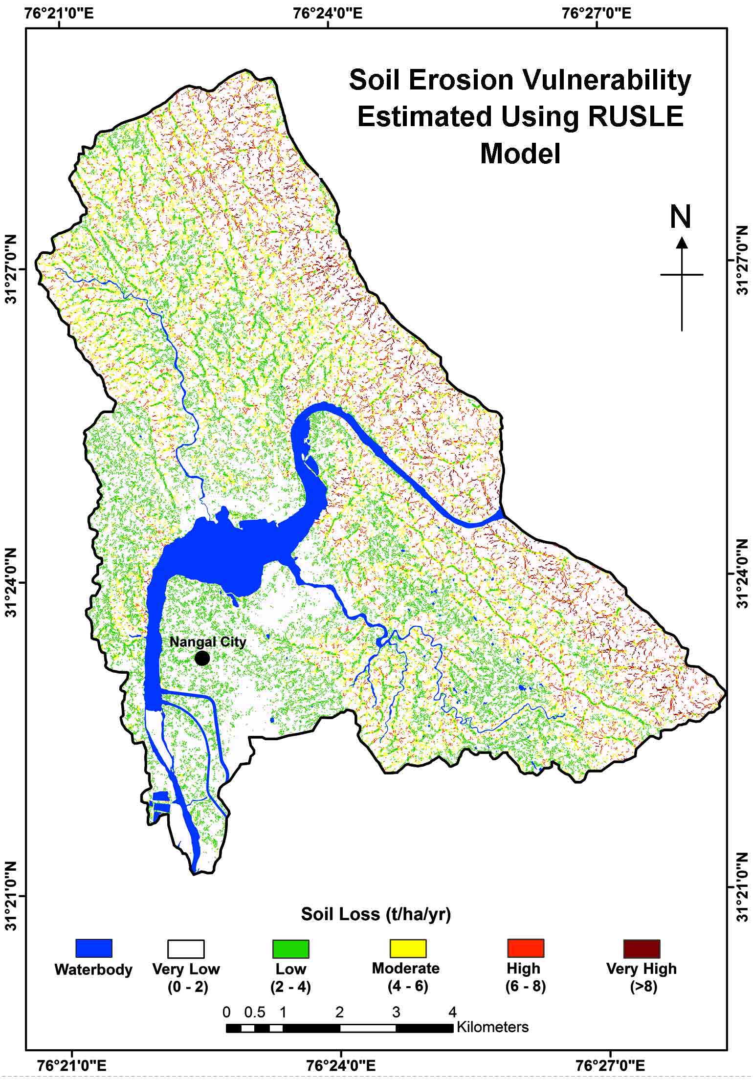
Modeling Soil Erosion Vulnerability Using RUSLE: A Case Study Upstream of Nangal Reservoir, India
Sunil Nehra, Koyel Sur, Vipan Verma
Simulation of soil erosion is an important phenomenon in watershed management studies because of the dynamic nature of soil. The present study demonstrates the capabilities of remote sensing coupled with GIS to extract soil erosion vulnerabilities using RUSLE model. Therefore this study understands spatial distribution of soil erosion at a macro-watershed scale. The input parameters for RUSLE model include the rainfa…
10.21523/gcj1.20040101 2,156 views 2 citations 30 Oct 2020
-
pp. 12-18 Open access
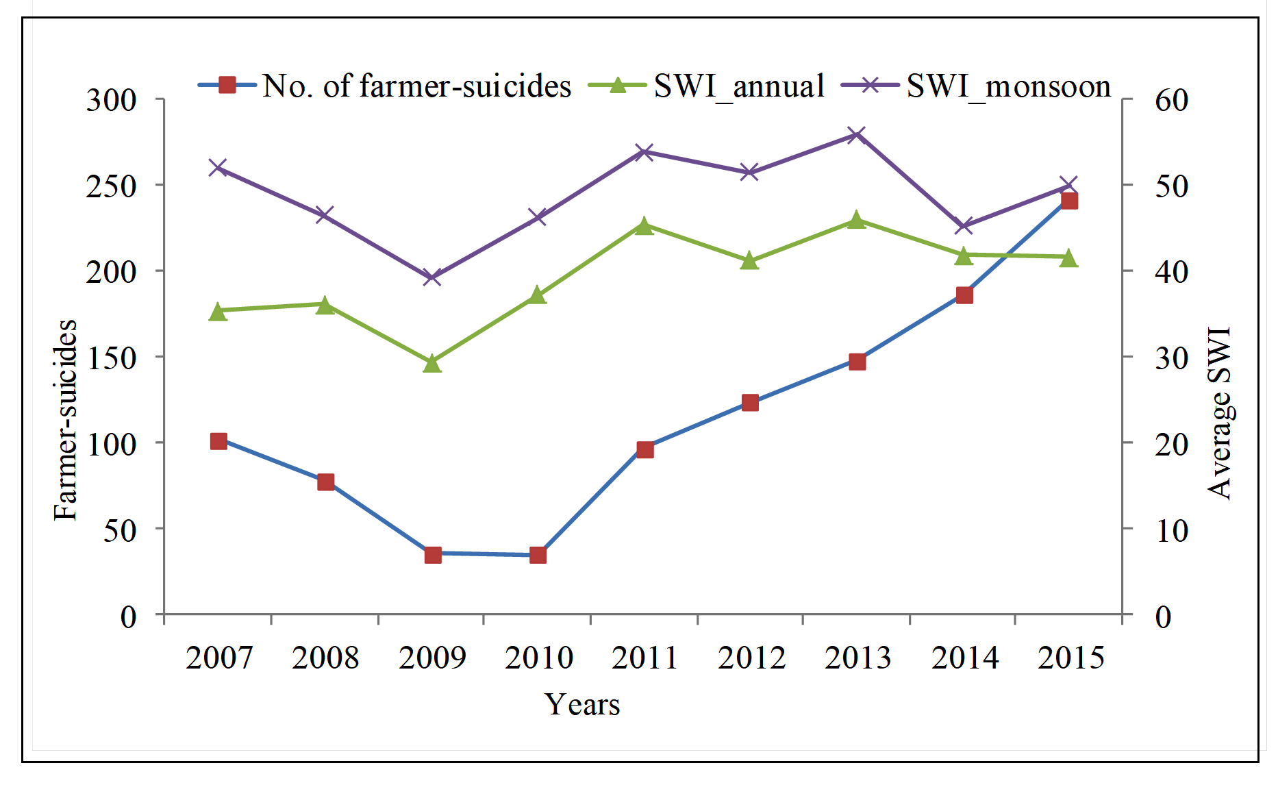
Satellite Data Based Soil Water Index as a Tool to Monitor Droughts and Agricultural Crisis -An Example of Yavatmal District, Maharashtra, India
Yavatmal is one of the drought prone districts in Maharashtra state of India and has witnessed an agricultural crisis to the extent that hundreds of its farmers have committed suicides in recent years. Satellite data based products have previously been used globally for monitoring and predicting of drought, but not for monitoring their extreme impacts that may include farmer-suicides. In this study, the performance o…
10.21523/gcj1.20040102 899 views 19 Nov 2020
-
pp. 19-39 Open access
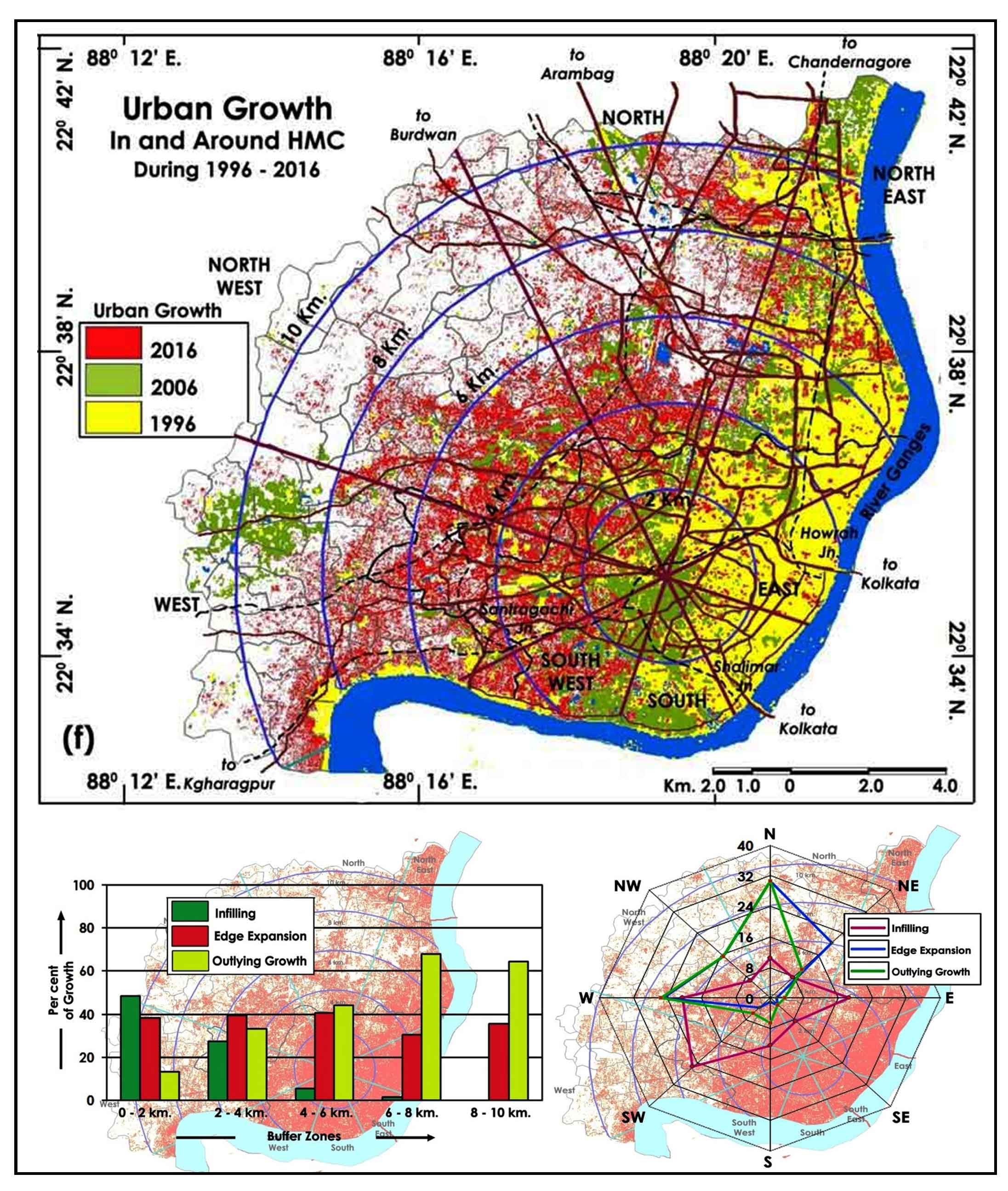
Monitoring and Measuring the Urban Forms Using Spatial Metrics of Howrah City, India
Somnath Mandal, Sanjit Kundu, Subrata Haldar, Subhasis Bhattacharya, SUMAN PAUL
Monitoring and measurement of urban growth pattern with the help of urban-rural gradient and spatial metrics are gaining significant importance in recent times. Rapid and unplanned urban growth has a great impact on natural resources, local ecology, forestry and infrastructure. Temporal satellite data, gradient analysis and landscape metrics of urban landscapes will help to evolve appropriate strategies for integrate…
10.21523/gcj1.20040103 2,616 views 7 citations 22 Nov 2020
-
pp. 40-58 Open access
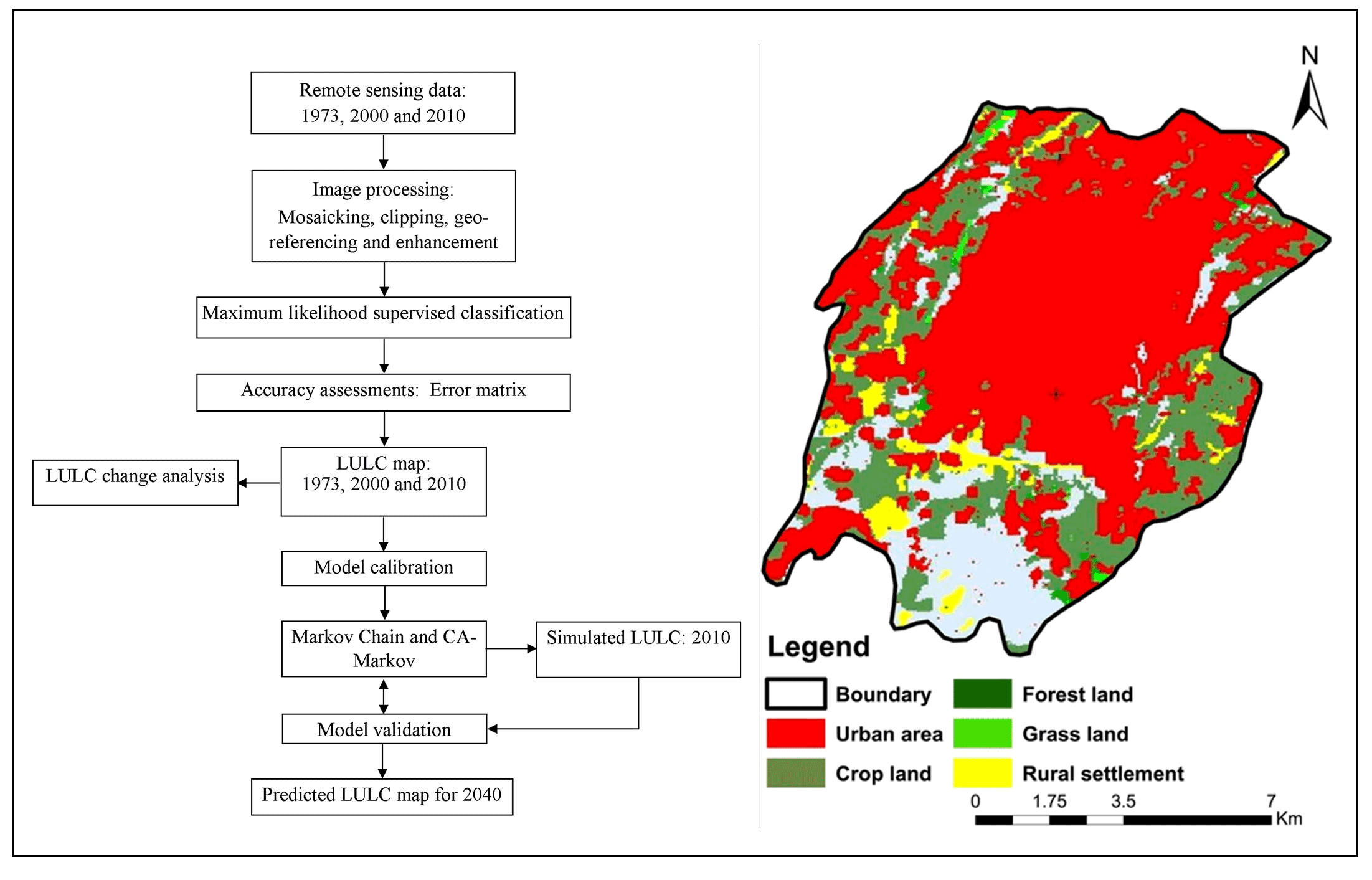
Analysis of Urban Expansion and Modeling of LULC Changes Using Geospatial Techniques: The Case of Adama City
Bedasa Regassa, Mikir Kassaw, Murugesan Bagyaraj
In the last decades, Adama city has experienced drastic changes in its shape, not just in its vast geographical expansion, but also by internal transformations. Subsequently, understanding and evaluating the spatiotemporal variability of urban land use and land cover (LULC) shifts, and it is important to bring forth the right strategies and processes to track population development in decision-making. The goal of thi…
10.21523/gcj1.20040104 10,843 views 14 citations 30 Dec 2020
Credits to reviewers (32)
- Dr. Vijay Bhagat, Post-graduate Research Centre in Geography, Agasti Arts, Commerce and Dadasaheb Rupwate Science College, Akole-422601, Ahmednagar, Maharashtra (India).
- Dr. Lachezar Filchev, Department of Remote Sensing and GIS, Space Research and Technology Institute at the Bulgarian Academy of Sciences (SRTI-BAS).
- Dr. Tarik Mitran, National Remote Sensing Centre, ISRO,Hyderabad – 500037 (India)
- Dr. Vanya Stamenova, Space Research and Technology Insitute - Bulgarian Academy of Sciences
- Dr. Chaitanya Pande, All India coordinate research project for dry land agriculture, Dr. Panjabrao Deshmukh Krishi Vidyapeeth, Akola
- Dr. Kishor R. Sonawane, Post-graduate Research Centre in Geography, Agasti Arts, Commerce and Dadasaheb Rupwate Science College, Akole-422601, Ahmednagar, Maharashtra (India).
- Professor. Ayad Al-Quraishi, Environmental Engineering Dept., College of Engineering, Knowledge University, Erbil 44001
- Dr. Sainath Aher, Post Graduate Department of Geography, S. N. Arts, D. J. Malpani Commerceand B.N. Sarda Science College, Sangamner 422 605, India
- Mr. Milad Janalipour, Department of Photogrammtery & Remote SensingFaculty of Geodesy and Geomatics EngineeringK. N. Toosi University of Technology
- Professor. Ali Mohammadzadeh, Remote Sensing Dept., Faculty of Geomatics Engineering, K.N.Toosi University of Technology, Tehrān, Iran.
- Dr. S. Sarvade, Assistant Professor, Department of Forestry, JNKVV Jabalpur
- Dr. SN Patil, Department of Geology, School of Environmental and Earth Sciences, North Maharashtra University, Jalgaon-425001, Maharashtra (India)
- Dr. Shridhar Jawak, University Centre in Svalbard (UNIS), SIOS - Svalbard Integrated Arctic Earth Observing System, SIOS Knowledge Centre, P.O. Box 156, N-9171 Longyearbyen, Norway.
- Dr. Ajaykumar Kadam, Department of Geology, Savitribai Phule Pune University, Pune
- Mr. Kajal Kumar Mandal, Department of Disaster Management, Pondicherry University, Port Blair Campus, Andaman, India.
- Dr. Rajasekhar M, Department of Geology, Yogi Vemana University, Kadapa-516003, Andhra Pradesh (India).
- Dr. Hamdi Zurqani, University of Tripoli, Department Soil and Water Sciences
- Dr. K. V. Suryabhagavan, School of Earth Sciences, Addis Ababa University, P.O. Box 1176, Addis Ababa, Ethiopia.
- Dr. S.P Rao, University of Dodoma
- Mr. Abhishek Danodia, Indian Institute of Remote Sensing
- Mrs. Minakshi Kumar, Indian Institute of Remote Sensing
- Dr. Satyajit Gaikwad, Department of Geology, Savitribai Phule Pune University, Pune
- Dr. SHANKAR KARUPPANNAN, Department of Aplied Geology,School of Applied Natural Sciences (SoANS), Adama Science & Technology University, Adama, Ethiopia.
- Mr. Justin George K, Indian Institute of Remote Sensing
- Dr. Muhammad Sohail Memon, Department of Farm Power and Machinery, Faculty of Agricultural Engineering, Sindh Agriculture University, Tandojam, Pakistan
- Dr. Murugesan Bagyaraj, Department of Geology, College of Natural and Computational Sciences, Debre Berhan University, Debre Berhan, Ethiopia.
- Dr. Shrinwantu Raha, Bhairab Ganguly College, Belgharia-7,000,56, West Bengal, India.
- Dr. M. V Rao, Andhra University
- Dr. Pankaj Panwar, CSWCRTI, Chandigarh
- Dr. Sanjay Navale, Department of Geography, S. N. Arts, D.J.M. Commerce and B.N.S. Science College, Sangamner, Dist.Ahmednagar, Maharashtra (India), 422605.
- Mr. Justin George Kalambukattu, Agriculture and Soils Department,Indian Institute of Remote Sensing, ISRO, Dehradun 248001, Uttarakhand, India
- Professor. Rajendra Zolekar, Department of Geography, K.V. N.Naik College Nashik