Article Title :
Analysis of Remote Sensing based Vegetation Indices (VIs) for Unmanned Aerial System (UAS): A Review 

3 (2019)
58-73
Calibration , Canopy , Indices , NDVI , UAS , UAV , Vegetation




Unmanned Aerial System (UAS) is an efficient tool to bridge the gap between high expensive satellite remote sensing, manned aerial surveys, and labors time consuming conventional fieldwork techniques of data collection. UAS can provide spatial data at very fine (up to a few mm) and desirable temporal resolution. Several studies have used vegetation indices (VIs) calculated from UAS based on optical- and MSS-datasets to model the biophysical parameters of the Earth surface. They have used different techniques of estimations, predictions and classifications. However, these results vary according to used datasets and techniques and appear very site-specific. These existing approaches aren’t optimal and applicable for all cases and need to be tested according to sensor category and different geophysical environmental conditions for global applications. UAS remote sensing is a challenging and interesting area of research for sustainable land management.
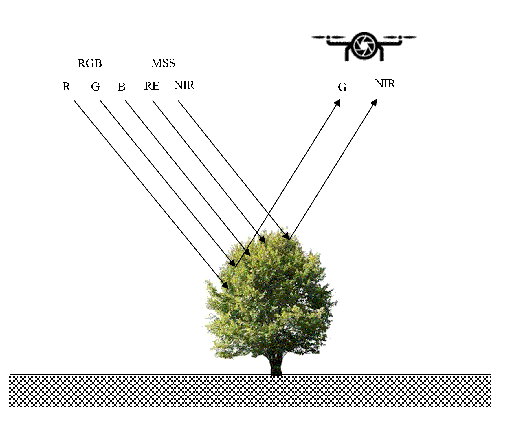
The Unmanned Aerial System (UAS) based Vegetative indices are critically reviewed in the paper.
Timely, intensive, cost effective and efficient data collection with less labor and time can be possible using UAV systems.
VIs is widely used for agricultural applications: leaf area estimations, canopy analysis, plant nutrients analysis (nitrogen status), biomass estimations, plant growth, crop yield estimations, etc.
UAV-RGB based vegetation indices have great potential of high precision and low-cost assessment, planning and monitoring of agriculture, water resources, settlements, deserters, etc.
Bendig, J., Yu, K., Aasen, H., Boltena, A., Bennertz, S., Broscheit, J., Gnyp, M. L. and Bareth, G., 2015. Combining UAV-based plant height from crop surface models, visible, and near infrared vegetation indices for biomass monitoring in barley. International Journal of Applied Earth Observation and Geoinformation, 39, 79-87.
Beniaich, A., Silva, M. L.N., Avalos, F. A. P., de Menezes, M. D., Cândido, B. M., 2019. Determination of vegetation cover index under different soil management systems of cover plants by using an unmanned aerial vehicle with an onboard digital photographic camera. Semina: Ciências Agrárias, Londrina, 40(1), 49-66.
Caturegli, L., Gaetani, M., Volterrani, M., Magni, S., Minelli, A., Baldi, A., Brandani, G., Mancini, M., Lenzi, A., Orlandini, S., Lulli, F., de Bertoldi, C., Dubbini, M. and Grossi, N., 2019. Normalized difference vegetation index versus dark green colour index to estimate nitrogen status on bermudagrass hybrid and tall fescue. International Journal of Remote Sensing.
Cermakova, I., Komarkova, J. and Sedlak, P., 2019. Calculation of visible spectral indices from UAV-based data: Small water bodies monitoring. 14th Iberian Conference on Information Systems and Technologies (CISTI), 1-5.
Eng, L. S., Ismai, R., Hashim, W., Mohamed, R. R., and Baharum, A., 2018. Vegetation monitoring using UAV: A preliminary Study. International Journal of Engineering and Technology, 7, 223-227.
ICAO, 2011. ICAO Circular 328, Unmanned aircraft systems (UAS). Technical Report. International Civil Aviation Authority. Montral, Canada.
Jiany G., Haiganga S., Guoruia M. and Qiming Z., 2008. A review of multi-temporal remote sensing data change algorithms. The International Archives of the Photogrammetry, Remote Sens. Spatial Infor. Sci., 37 (B7), 757-762.
Kauth, R. J., and Thomas, G. S., 1976. The tassled cap-a graphic description of the spectral-temporal development ofagricultural crops as seen by Landsat. Proceedings oftile Symposium Oil Machine Processinq of Remotely Sensed Data. Laboratory for Applications of Remote Sensing (West Lafayette, Indiana: Purdue University), 41-57.
Merz, T. and Chapman, S., 2011. Autonomous unmanned helicopter system for remote sensing missions in unknown environments. Int. Arch. Photogram. Remote Sens. Spat. Inf. Sci., 31-38.
Oliveira de, R. A., Näsi, R., Niemeläinen, O., Nyholm, L., Alhonoja, K., Kaivosoja, J., Viljanen, N., Hakala, T., Nezami, S., Markelin, L., Jauhiainen, L., Honkavaara, E., 2019. Assessment of RGB and hyperspectral UAV remote sensing for grass quantity and quality estimation. The International Archives of the Photogrammetry, Remote Sensing and Spatial Information Sciences, XLII-2/W13, 10-14.
Sankaran, S., Khot, L .R., Espinoza, C. Z., Jarolmasjed, S., Sathuvalli, V. R., Vandemark, G. J., Miklas, P. N., Carter, A. H., Pumphrey, M. O., Knowles, N. R., and Pavek, M. J., 2015. Low-altitude, high-resolution aerial imaging systems for row and field crop phenotyping: A review. Europ. J. Agronomy, 70, 112-123.