
Journal Open access Double-blind peer review
Remote Sensing of Land
'Remote Sensing of Land' (RSL) publishes double-blind peer-reviewed articles within all fields of remote sensing of the land.
Editor-in-Chief Dr. Suresh Kumar (Agriculture, Forestry & Ecology Group, Indian Institute of Remote Sensing, Dehra Dun -248001, Uttarakhand, India.)
Managing Editor Dr. Kalpana Bhagat  (Gatha Cognition.)
- Articles published
- 38
- Crossref citations
- 292
- Citation ratio · Crossref
- 7.68
- Citation ratio · OpenAlex
- 9.55
- Days to first decision
- 50
Citation ratio = citations ÷ all articles published since the first issue. Days to first decision = median days from submission to the editor’s first decision, for the last 20 manuscripts (submitted since May 2021).
Issue
Volume 3 (2019) · Issue 2
Original Research Paper
-
pp. 50-58 Open access
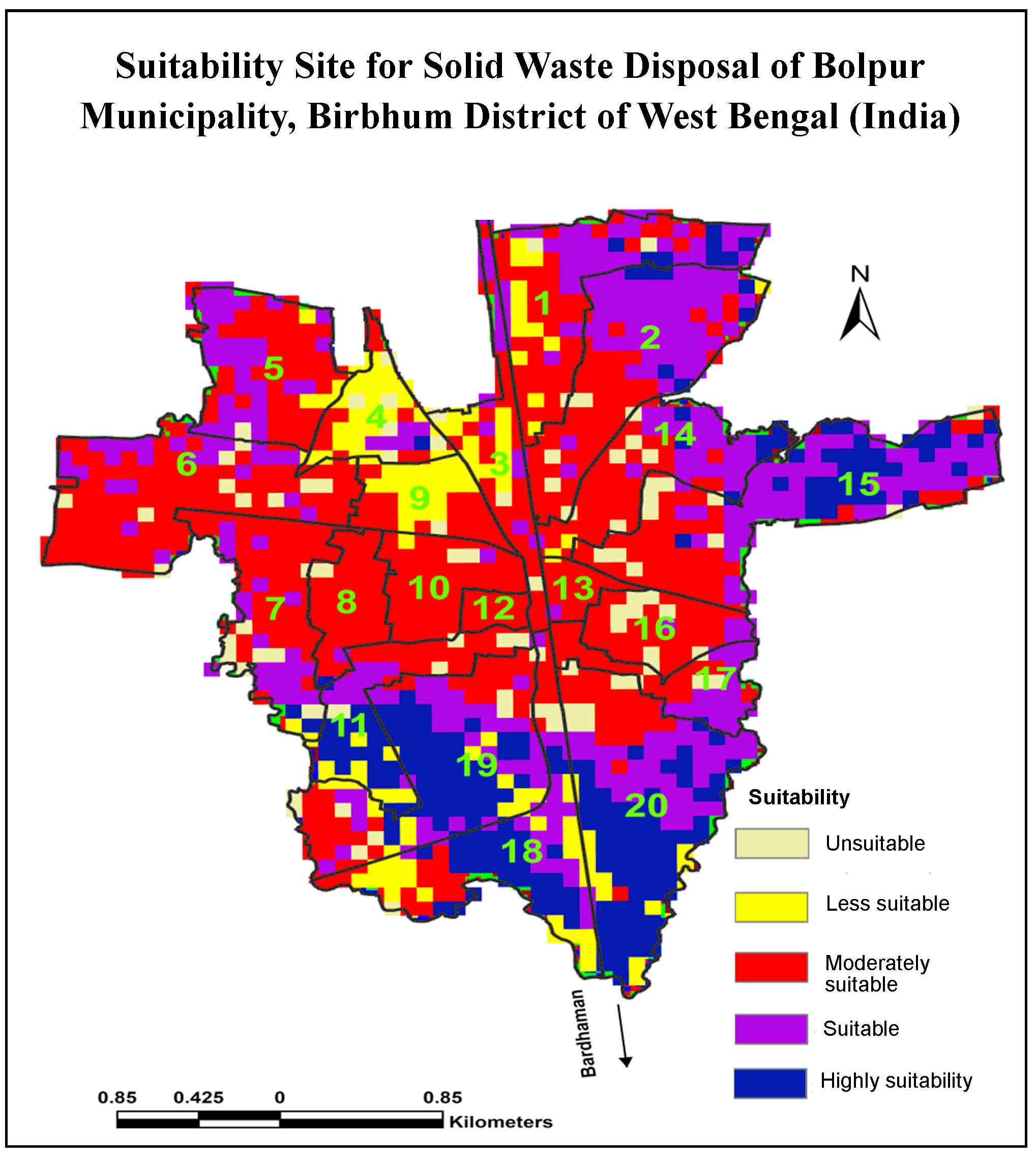
Site Suitability Analysis for Solid Waste Disposal of Bolpur Municipality, Birbhum District of West Bengal (India): Remote Sensing and AHP Approach
The aim of present study is to find out suitable sites for solid waste disposal (SWD) in the tropical moist sub-humid region of Bolpur municipality, Birbhum district, West Bengal, India using Remote Sensing (RS), Geographic Information System (GIS) and Analytical Hierarchy Process (AHP) techniques. Saaty’s AHP technique was used to delineate the suitable sites for SWD using thematic layers such as land use/land cover…
10.21523/gcj1.19030201 1,021 views 4 Aug 2020
Review Article
-
pp. 58-73 Open access
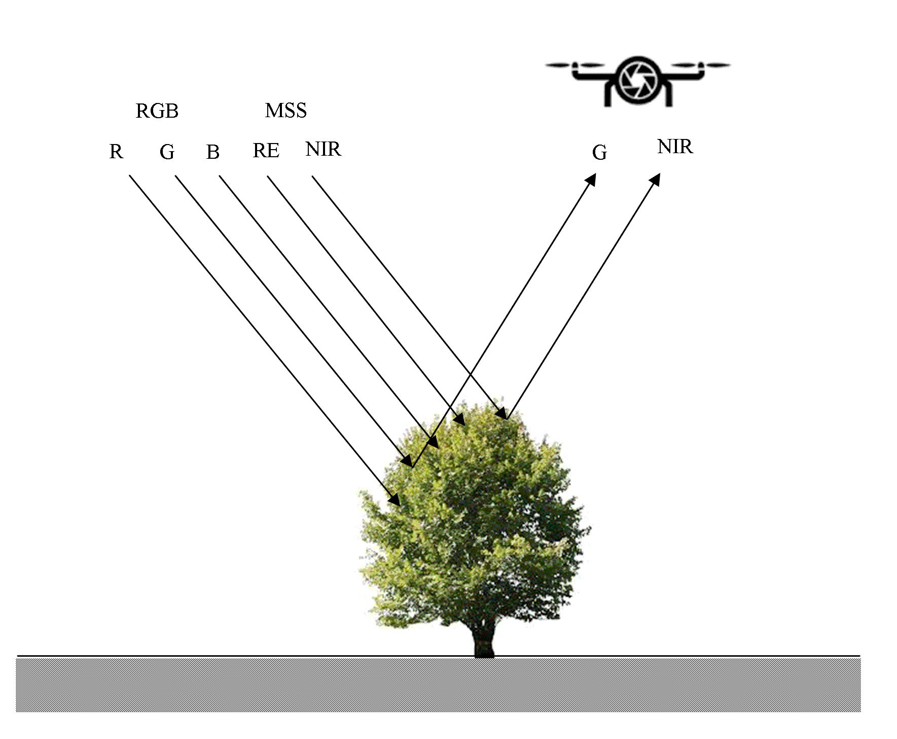
Analysis of Remote Sensing based Vegetation Indices (VIs) for Unmanned Aerial System (UAS): A Review
Vijay Bhagat, Ajaykumar Kadam, Suresh Kumar
Unmanned Aerial System (UAS) is an efficient tool to bridge the gap between high expensive satellite remote sensing, manned aerial surveys, and labors time consuming conventional fieldwork techniques of data collection. UAS can provide spatial data at very fine (up to a few mm) and desirable temporal resolution. Several studies have used vegetation indices (VIs) calculated from UAS based on optical- and MSS-datasets…
10.21523/gcj1.19030202 1,754 views 9 citations 29 Sep 2020
Credits to reviewers (32)
- Dr. Vijay Bhagat, Post-graduate Research Centre in Geography, Agasti Arts, Commerce and Dadasaheb Rupwate Science College, Akole-422601, Ahmednagar, Maharashtra (India).
- Dr. Lachezar Filchev, Department of Remote Sensing and GIS, Space Research and Technology Institute at the Bulgarian Academy of Sciences (SRTI-BAS).
- Dr. Tarik Mitran, National Remote Sensing Centre, ISRO,Hyderabad – 500037 (India)
- Dr. Vanya Stamenova, Space Research and Technology Insitute - Bulgarian Academy of Sciences
- Dr. Chaitanya Pande, All India coordinate research project for dry land agriculture, Dr. Panjabrao Deshmukh Krishi Vidyapeeth, Akola
- Dr. Kishor R. Sonawane, Post-graduate Research Centre in Geography, Agasti Arts, Commerce and Dadasaheb Rupwate Science College, Akole-422601, Ahmednagar, Maharashtra (India).
- Professor. Ayad Al-Quraishi, Environmental Engineering Dept., College of Engineering, Knowledge University, Erbil 44001
- Dr. Sainath Aher, Post Graduate Department of Geography, S. N. Arts, D. J. Malpani Commerceand B.N. Sarda Science College, Sangamner 422 605, India
- Mr. Milad Janalipour, Department of Photogrammtery & Remote SensingFaculty of Geodesy and Geomatics EngineeringK. N. Toosi University of Technology
- Professor. Ali Mohammadzadeh, Remote Sensing Dept., Faculty of Geomatics Engineering, K.N.Toosi University of Technology, Tehrān, Iran.
- Dr. S. Sarvade, Assistant Professor, Department of Forestry, JNKVV Jabalpur
- Dr. SN Patil, Department of Geology, School of Environmental and Earth Sciences, North Maharashtra University, Jalgaon-425001, Maharashtra (India)
- Dr. Shridhar Jawak, University Centre in Svalbard (UNIS), SIOS - Svalbard Integrated Arctic Earth Observing System, SIOS Knowledge Centre, P.O. Box 156, N-9171 Longyearbyen, Norway.
- Dr. Ajaykumar Kadam, Department of Geology, Savitribai Phule Pune University, Pune
- Mr. Kajal Kumar Mandal, Department of Disaster Management, Pondicherry University, Port Blair Campus, Andaman, India.
- Dr. Rajasekhar M, Department of Geology, Yogi Vemana University, Kadapa-516003, Andhra Pradesh (India).
- Dr. Hamdi Zurqani, University of Tripoli, Department Soil and Water Sciences
- Dr. K. V. Suryabhagavan, School of Earth Sciences, Addis Ababa University, P.O. Box 1176, Addis Ababa, Ethiopia.
- Dr. S.P Rao, University of Dodoma
- Mr. Abhishek Danodia, Indian Institute of Remote Sensing
- Mrs. Minakshi Kumar, Indian Institute of Remote Sensing
- Dr. Satyajit Gaikwad, Department of Geology, Savitribai Phule Pune University, Pune
- Dr. SHANKAR KARUPPANNAN, Department of Aplied Geology,School of Applied Natural Sciences (SoANS), Adama Science & Technology University, Adama, Ethiopia.
- Mr. Justin George K, Indian Institute of Remote Sensing
- Dr. Muhammad Sohail Memon, Department of Farm Power and Machinery, Faculty of Agricultural Engineering, Sindh Agriculture University, Tandojam, Pakistan
- Dr. Murugesan Bagyaraj, Department of Geology, College of Natural and Computational Sciences, Debre Berhan University, Debre Berhan, Ethiopia.
- Dr. Shrinwantu Raha, Bhairab Ganguly College, Belgharia-7,000,56, West Bengal, India.
- Dr. M. V Rao, Andhra University
- Dr. Pankaj Panwar, CSWCRTI, Chandigarh
- Dr. Sanjay Navale, Department of Geography, S. N. Arts, D.J.M. Commerce and B.N.S. Science College, Sangamner, Dist.Ahmednagar, Maharashtra (India), 422605.
- Mr. Justin George Kalambukattu, Agriculture and Soils Department,Indian Institute of Remote Sensing, ISRO, Dehradun 248001, Uttarakhand, India
- Professor. Rajendra Zolekar, Department of Geography, K.V. N.Naik College Nashik